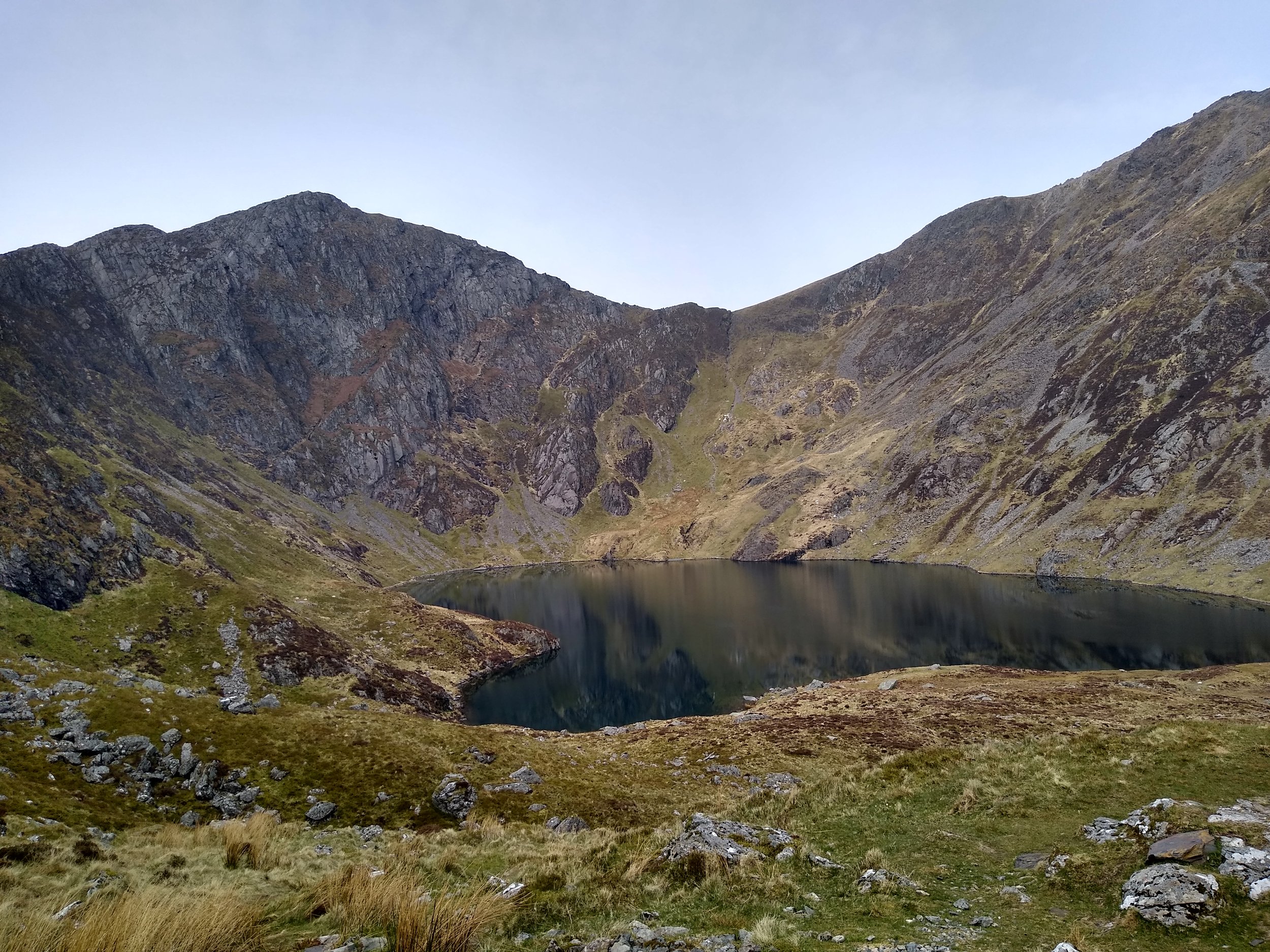
Cadair Idris horseshoe from Dol Idris/Minffordd.
Cadair Idris is a perfect example of glacial mountains: The range sits tallest in a row of parallel hills split by estuaries and valleys carved as glaciers retreated towards what is now the Irish Sea. The cwm in which Llyn Cau sits was carved by a cirque glacier, and its steep walls and vast bowl shape led to the legendary name: Cadair Idris, or Idris’ Chair.
There is a local saying that ‘if you spend a night on Cadair Idris you will wake up either a poet or a madman.’ Sadly many fall into the latter as summer weekends see Llyn Cau occupied with campers pitching conspicuously through the daytime, seemingly unaware of Leave No Trace principles. This appears to be subsiding as the pandemic fly-camping phenomenon dissipates, but at such times responsible LNT wild campers would do better to find a quiet spot on the northern side: arguably with much better views overlooking Barmouth and the Mawddach estuary.
Walkers may also be interested in visiting the hamlet of Llanfihangel y Pennant. Besides being the site of Castell y Bere (a 12th Century castle built by Llewelyn mab Iorweth) it was also the home of Mary Jones who, in 1800 at the age of sixteen, walked 26 miles barefoot to Bala as it was the nearest place to buy a Welsh copy of the Bible. A monument now stands on the site of her cottage, and the Mary Jones Walk is a multi-day route that follows in her footsteps.
Click the image to open the OutdoorActive route card
Key Details:
Distance: 6.7 miles / 10.8km
Elevation Gain: 3250ft / 990m
Terrain: Rocky paths most of the way to the summit, then descending via steep grassy slope (not exposed) back to the woodland to re-join the stepped path. Those with weak knees may find trekking poles useful on the descent.
Start/Finish: Bus stop - Gwesty Minffordd. Car park - Dol Idris.
Public Transport
Good services 7 days per week.
Trawscymru T2: Connects Aberystwyth to Bangor, calling at Machynlleth, Dolgellau, Porthmadog and Caernarfon as principle and connection stops.
Bus stop: This is not marked on the timetables, but is between the stops of Corris and Dolgellau and the driver will stop upon request for either ‘Dol Idris or Gwesty Minffordd (Hotel)’. For southbound wait on the grass verge opposite the pub.
Route Notes:
1. Start: From the Minffordd Hotel, bear right off the main road and go into the Dol Idris National Park carpark. Head over the carpark, past the toilets and follow the straight track until passing through a kissing gate to reach the visitor centre.
2. 0.3 miles: At the visitor centre turn left and after 50m cross a bridge over a stream. After crossing the bridge, turn right and pass through the gate in the drystone wall. Follow the steep steps through the woodland, keeping the stream to the right.
3. 0.6 miles: A drystone wall marks the end of the woodland, and passing through the gate will lead onto open fell. After a few minutes the path will split. The path splitting off to the right and over a stream is the return path of the horseshoe. Do not take this path, instead continue on the left for another 0.5 miles.
4. 1.3 miles: At this point Llyn Cau will be coming into view. Leave the main path temporarily and head down to the lake for a well-deserved break! When ready, return to the stony stepped path and climb steeply uphill until approaching a cairn as it levels out.
5. 2.0 miles: Turn right at the cairn. The path will continue to climb, gradually curving to the right following the carve of the glacial bowl.
6. 2.7 miles: The top of this climb is marked by a wire fence and stile when reaching Craig Cwm Amarch. Cross the stile, and the path will briefly descend towards a col before the climb resumes.
7. 3.1 miles: Shortly after resuming the ascent, the path will become rockier and less defined. However, cairns are marked at regular intervals guide walkers in cloud to the trigpoint, and just on the north side of the trigpoint is a summit shelter.
8. 3.5 miles: From the summit shelter the paths become grassy sheep-tracks. Follow these along the broadest and highest parts of the plateau until reaching a wire fence. Cross this and continue to the summit of Mynydd Moel.
9. 4.6 miles: Walk back to the wire fence and, keeping it on your right, follow it down a steep and long mile until reaching a stile.
10. 5.6 miles: Cross the style and follow this path for roughly 10 minutes, reaching a stream.
11. 6.0 miles: Cross the stream, and re-join the path used to ascend to Llyn Cau. Follow the original path back to the car park, or bus stop.
